
MARINO PH
Your Maritime Digital Hub

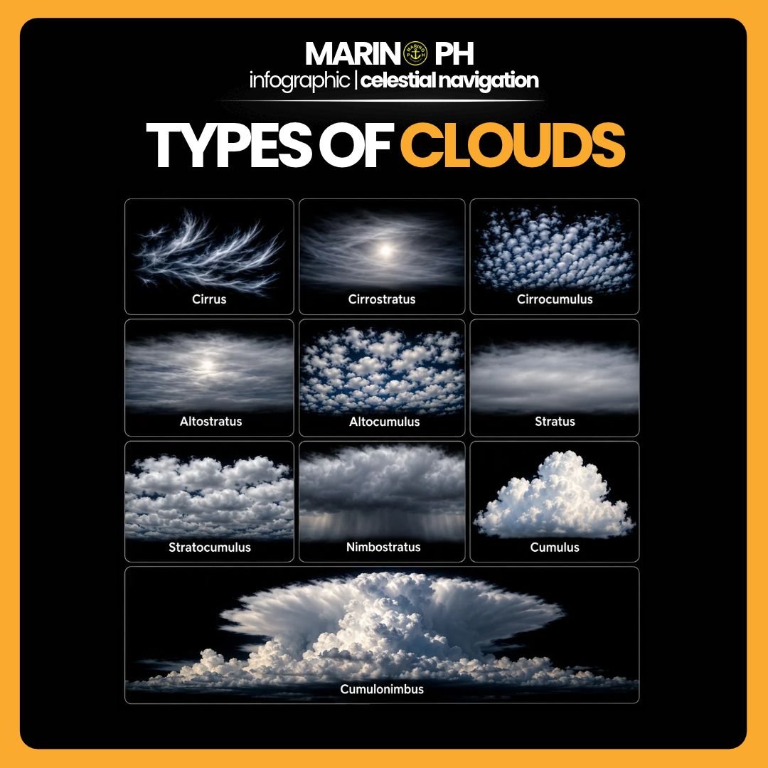
Clouds are important indicators of atmospheric conditions and weather changes. For seafarers, recognizing different cloud types helps in understanding weather patterns, anticipating changes in wind and visibility, and identifying potential hazards during navigation. Clouds are classified into ten main types based on their appearance, altitude, and development.

1. Cirrus
Cirrus clouds are thin, white, and feathery clouds found at high altitudes. They consist mainly of ice crystals and generally occur during fair weather. However, increasing cirrus cloud cover may indicate an approaching weather system or warm front.
2. Cirrostratus
Cirrostratus clouds form a thin, transparent layer across the sky, often producing a halo around the Sun or Moon. These high-level clouds consist of ice crystals and may indicate increasing atmospheric moisture ahead of an approaching frontal system.
3. Cirrocumulus
Cirrocumulus clouds appear as small, white patches or ripples arranged in rows or groups. They form at high altitudes and consist mainly of ice crystals or supercooled water droplets. They generally produce no precipitation reaching the surface.
4. Altostratus
Altostratus clouds form extensive gray or bluish-gray layers at middle altitudes. They often cover large portions of the sky, allowing the Sun to appear faintly through the cloud layer. These clouds may precede widespread precipitation associated with frontal systems.
5. Altocumulus
Altocumulus clouds appear as white or gray rounded patches, often arranged in groups or waves at middle altitudes. They usually indicate moisture and atmospheric movement. Certain developing forms, particularly altocumulus castellanus, may signal atmospheric instability and possible thunderstorms.
6. Stratus
Stratus clouds form low, uniform gray layers resembling fog above the Earth\'s surface. They may produce mist or light drizzle and can reduce visibility, particularly in coastal waters and during port approaches.
7. Stratocumulus
Stratocumulus clouds are low-level clouds appearing as large, rounded masses or continuous patches with darker areas. They commonly occur during relatively stable atmospheric conditions and may occasionally produce light precipitation.
8. Nimbostratus
Nimbostratus clouds form thick, dark gray layers that cover extensive areas of the sky. They are associated with widespread, continuous rain or snow. These clouds can produce prolonged precipitation and reduced visibility, affecting navigation and shipboard operations.
9. Cumulus
Cumulus clouds are white, fluffy clouds with relatively flat bases and rounded tops. They commonly develop through rising warm air and are often associated with fair weather. However, continued vertical growth may indicate increasing atmospheric instability.
10. Cumulonimbus
Cumulonimbus clouds are massive, vertically developed storm clouds that may extend from low altitudes to the upper troposphere. They are associated with thunderstorms, heavy rainfall, lightning, strong wind gusts, hail, and sometimes waterspouts. Their presence requires heightened caution during maritime navigation.
