MARINO PH
Your Maritime Digital Hub

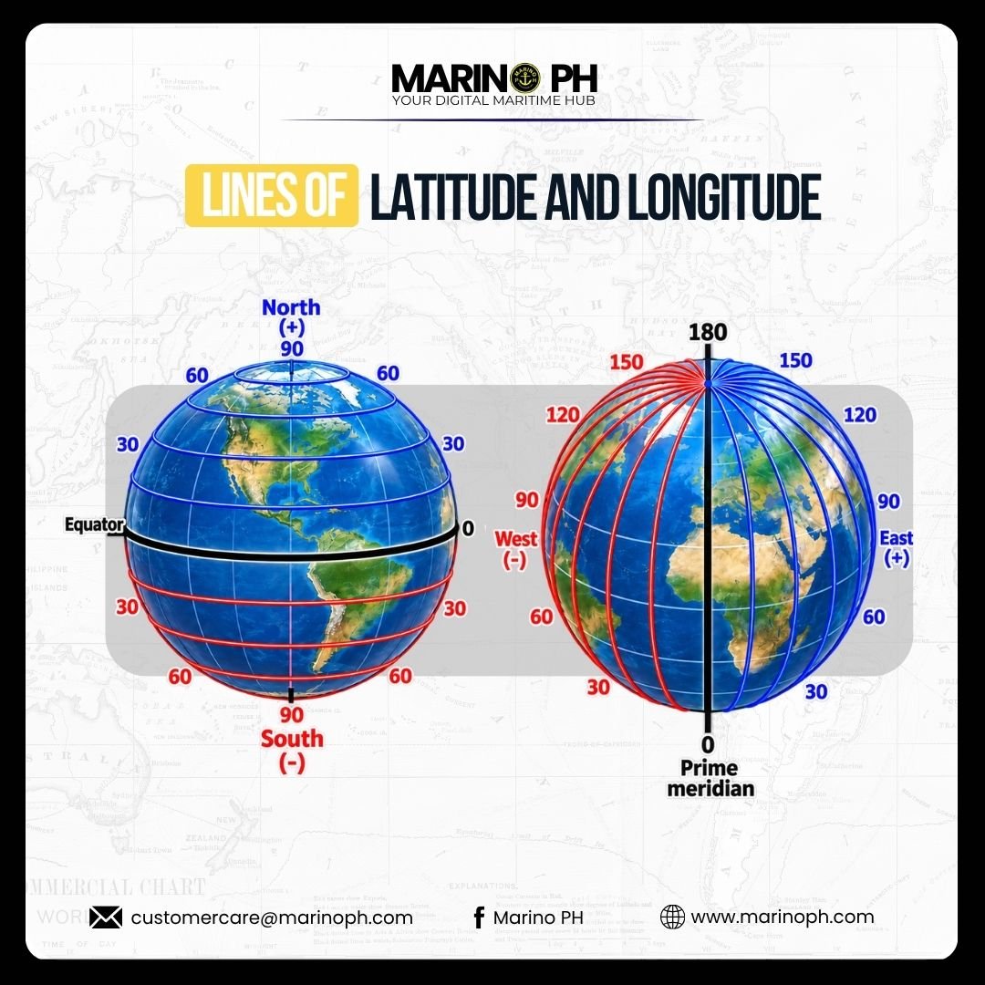
Latitude and longitude are imaginary reference lines used to determine the exact position of any place on Earth. They form the basis of the geographic coordinate system and are widely used in navigation, mapping, surveying, and positioning. For seafarers, understanding latitude and longitude is essential for plotting a vessel’s position, planning routes, and maintaining safe navigation at sea.
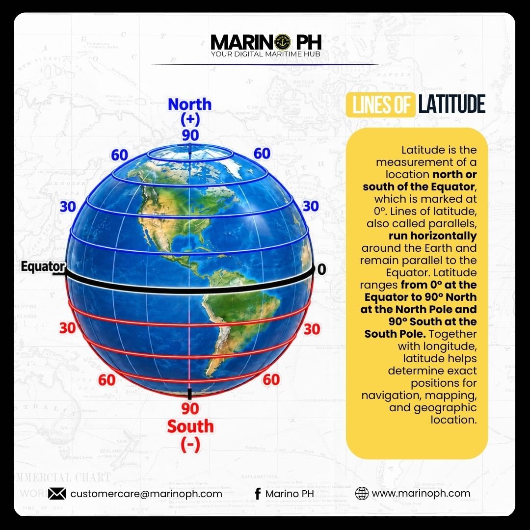
Latitude is the measurement of a location north or south of the Equator, which is marked at 0°. Lines of latitude, also called parallels, run horizontally around the Earth and remain parallel to the Equator. Latitude ranges from 0° at the Equator to 90° North at the North Pole and 90° South at the South Pole. Together with longitude, latitude helps determine exact positions for navigation, mapping, and geographic location.
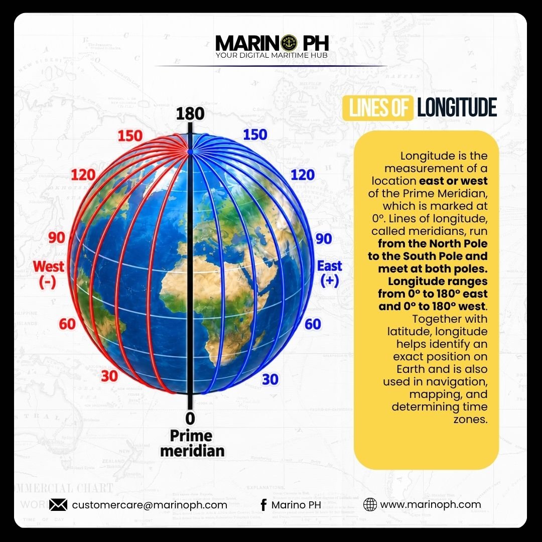
Longitude is the measurement of a location east or west of the Prime Meridian, which is marked at 0°. Lines of longitude, called meridians, run from the North Pole to the South Pole and meet at both poles. Longitude ranges from 0° to 180° east and 0° to 180° west. Together with latitude, longitude helps identify an exact position on Earth and is also used in navigation, mapping, and determining time zones.

Latitude and longitude work together as a coordinate system for identifying precise locations on the Earth’s surface. In maritime navigation, they are especially important for plotting a vessel’s position, planning routes, checking progress, and maintaining safe navigation at sea.
