MARINO PH
Your Maritime Digital Hub

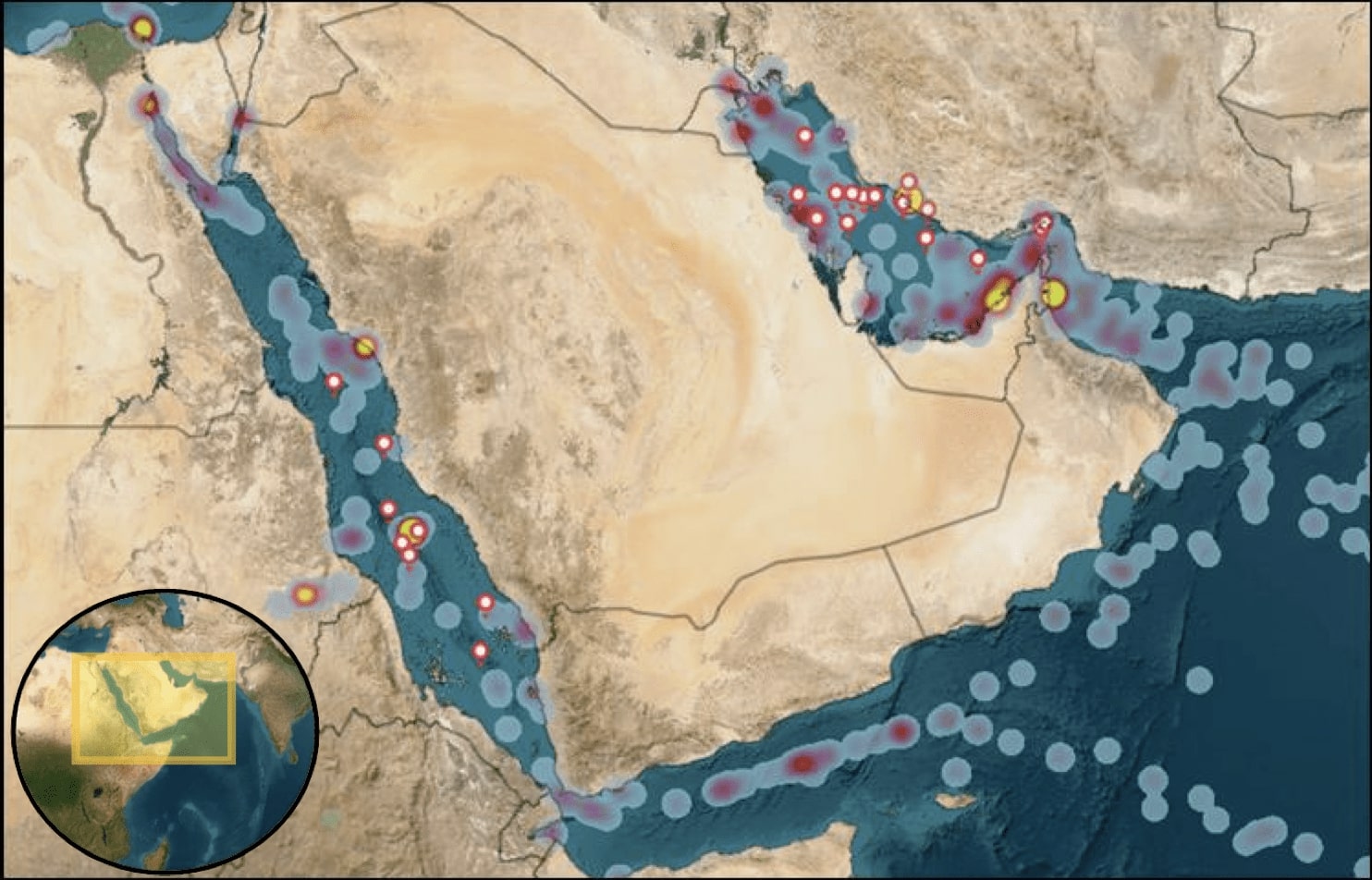
Image courtesy UKMTO
Significant GPS and satellite navigation disruptions have been reported across the Gulf region, raising serious safety and security concerns among maritime authorities and commercial operators.
According to reports from the UK Maritime Trade Operations (UKMTO) and vessel tracking data, widespread Global Navigation Satellite System (GNSS) interference and spoofing incidents have occurred between October 3 and 7, affecting areas from Bandar-e-Pars and the Strait of Hormuz to Port Sudan and the Suez Canal.
The disruptions reportedly caused vessel position errors, “location drifts,” and irregular AIS (Automatic Identification System) readings, complicating safe navigation in one of the world’s most critical maritime corridors.

ADVERTISEMENT
Maritime Operations Affected
In response, Qatar temporarily suspended maritime navigation nationwide on October 4, marking an unprecedented measure aimed at ensuring navigational safety. The restriction was later adjusted to permit limited daytime operations for small and non-conventional vessels, while maintaining nighttime sailing bans.
Tracking data indicated that LNG carriers and commercial ships near Doha and Ras Laffan were partially exempted from the restrictions. Some reports from the area described vessel locations appearing to “drift” toward Iranian waters, fueling speculation of deliberate GPS jamming or signal spoofing.
Rising Concerns Over Maritime Security
The latest incidents follow a series of warnings issued earlier this year by the Joint Maritime Information Center (JMIC), urging vessels transiting the Red Sea and Strait of Hormuz to maintain heightened vigilance and avoid relying solely on satellite navigation.
Experts warn that such interference—whether accidental or intentional—poses substantial risks to maritime safety, trade flow, and energy transport in a region that handles a significant portion of the world’s oil and LNG exports.

ADVERTISEMENT
Advisories and Recommendations
UKMTO has called on all vessels within the Voluntary Reporting Area to immediately report any cases of GNSS interference, including video or photographic evidence, to support ongoing investigations. Ship operators are advised to utilize alternative navigation methods, such as radar plotting and inertial navigation systems, when traversing affected zones.
Maritime authorities continue to monitor the situation closely, with investigations underway to determine the source and intent of the interference.
