MARINO PH
Your Maritime Digital Hub


The IALA Buoyage System was developed by the International Association of Marine Aids to Navigation and Lighthouse Authorities (IALA) to create a standard method of marking channels, hazards, and safe water. Its goal is to provide mariners with a reliable guide to safe navigation, no matter where they sail.
🔹IALA Regions
The system is divided into two regions:
Region A
Covers Europe, Africa, Australia, and most of Asia.
Port-hand marks: Red
Starboard-hand marks: Green
Region B
Covers the Americas, Japan, Korea, and the Philippines.
Port-hand marks: Green
Starboard-hand marks: Red
Types of IALA Marks
●Lateral Marks
- Show port and starboard sides of a channel.
- Colors depend on region (A or B).
●Cardinal Marks
-Indicate the safest water around a danger (North, South, East, West).
-Painted black and yellow with two triangles as topmarks.
-Lights flash quickly or very quickly.
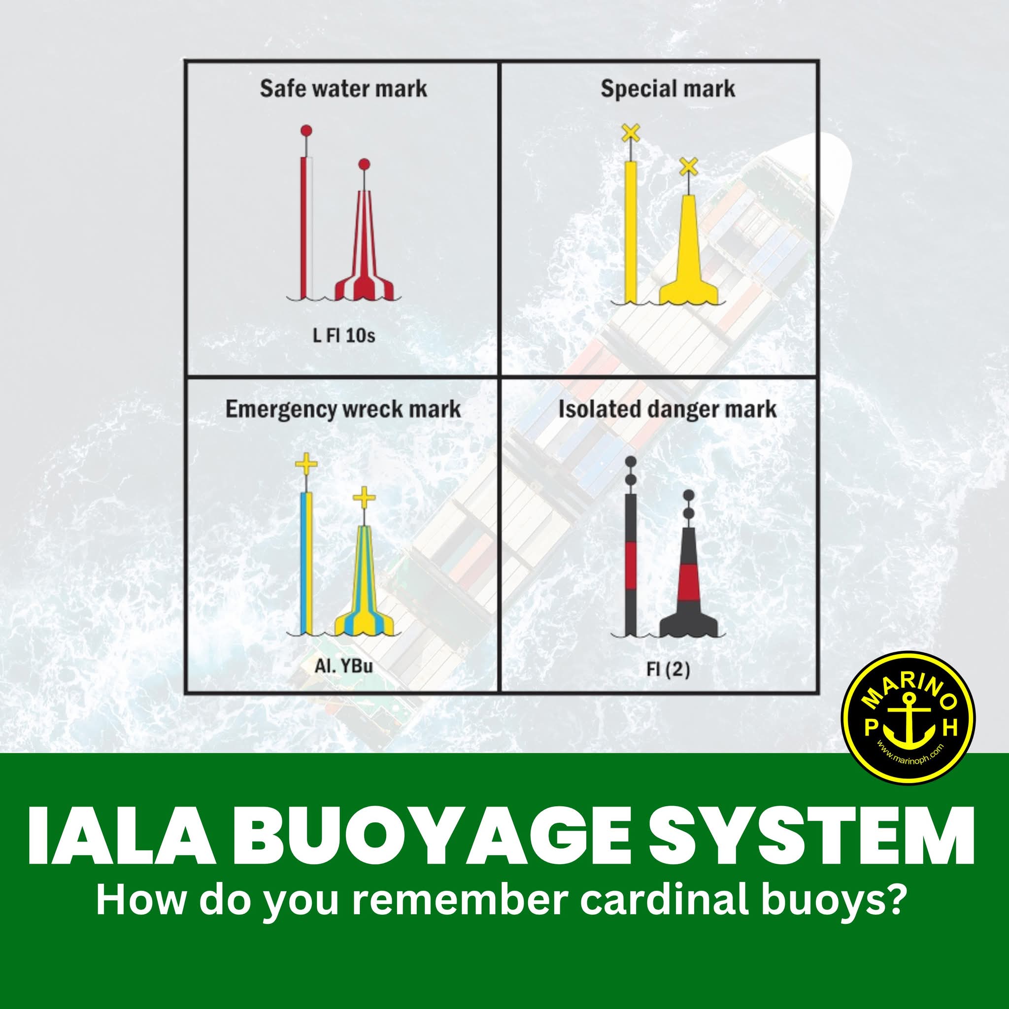
●Isolated Danger Marks
-Indicate a specific hazard such as a rock or wreck.
-Black with a red horizontal band and two black spheres on top.
-White light flashing in groups of two.
●Safe Water Marks
-Show there is navigable water all around.
-Red and white vertical stripes with a spherical topmark.
-White light showing a long flash or Morse code “A”.
●Special Marks
-Indicate designated areas like anchorages, pipelines, or restricted zones.
-Yellow with an “X” topmark and a yellow light.
The IALA Buoyage System is essential for safe and efficient maritime navigation. It provides a global standard for marking channels, hazards, and safe water, ensuring mariners can interpret navigation aids consistently worldwide. By using clear colors, shapes, topmarks, and lights, it helps prevent accidents such as collisions and groundings. Divided into Region A and Region B, the only difference lies in the color arrangement of lateral marks. Beyond safety, it supports smooth port operations, marks special zones like anchorages or pipelines, and strengthens compliance with international maritime safety regulations, making it vital for global shipping.